Common Challenges in Laser Surveying and How to Overcome Them
3D laser surveying has revolutionised the way we capture precise measurements of buildings, particularly in complex environments. From historic churches to modern offices, laser surveys provide a non-intrusive and fast way of gathering accurate spatial data.
However, like any advanced technology, laser surveying comes with its own set of challenges, which can vary depending on the building type, environment, and even the equipment itself.
This article will explore the common obstacles encountered during laser surveys across different building types and environments. Whether dealing with data noise in urban spaces, equipment calibration in detailed settings, or managing limited range in dense areas, each challenge requires strategic approaches. We will also touch on practical ways to overcome these difficulties, and the importance of having skilled operators to maximise the efficiency and accuracy of laser surveys.
Challenges in different types of buildings
The challenges encountered during laser surveys can vary depending on the type of building being surveyed. Factors such as building age, design complexity and the surrounding environment can all affect the scanning process.
As surveyors, we need to navigate physical obstructions, expertly manage equipment calibration, and mitigate data noise caused by moving objects, shadows or reflective surfaces, for example. Understanding these variables is crucial for ensuring accurate results, wherever we are working.
Let’s look at a few specific examples of challenges that arise at some of the most common types of scanning sites.
Laser surveys in schools
Schools present unique challenges for laser surveying, mostly due to the need for efficiency and minimal disruption.
With tight schedules during term time, surveyors often need to work during breaks or after hours to avoid interference with daily activities. The efficient flow through a building is particularly tricky in schools, where multiple small rooms and narrow corridors require careful planning to ensure accurate data capture.
Additionally, DBS-checks are more often than not required to comply with safeguarding regulations, adding an extra layer of administrative preparation.
The very nature of a school where there are children running around, kicking balls and knocking into tripods can present dangerous environments for sensitive equipment. A knocked survey tripod saps into site survey time where resetting and re-capturing detail will be necessary. Not to mention the potential for a fallen instrument to end surveying altogether. Replacements and repair are extremely costly.
In environments like these, the expertise of experienced surveyors is essential to manage the survey environment safely and efficiently, ensuring that the survey is both fast and precise.
Whilst inquisitive students asking questions during our work can be disruptive, on the upside, it is actually very rewarding to be able to share our expertise and provide that valuable learning opportunity – these may be our surveyors of the future!
Laser scanning in churches
Churches often present challenges for laser surveying due to their intricate architectural details, large spaces, and high ceilings. Features like vaulted ceilings, ornate carvings, and narrow alcoves require exceptional attention to detail to capture fully and accurately, making these projects particularly demanding.
The sheer size of many churches means that an increased number of scanner locations may be necessary to capture all the required data, and with location-specific instrument settings – experience and knowledge are vital.
A key factor in ensuring the best accuracy is the importance of equipment calibration and settings.
Firstly, due to the precision required in the manufacture of these modern machines to achieve the accuracy demanded, the equipment must be calibrated and serviced regularly by specialist, manufacturer-authorised personnel. And secondly, achieving the right settings is critical to ensure the scan resolution and quality is high enough to capture fine details, such as decorative mouldings, carvings and stonework at distance.
Both the resolution and the quality affect the scan time, so to be efficient on site while still maintaining detail-specific accuracy is a function of the experience of the surveyor. Resolution is often well understood (yet needs due consideration), but the quality of scans is a setting which determines how many times each individual scan point (of which there are many millions per scan) is verified under the same scanner set-up. If this setting is too low, the detail captured may not be clearly defined. Too high and you are wasting time on site.
Good calibration and settings are both also crucial to ensure that the ‘registration’ (stitching individual scans together) in the office is as precise as it can be – an extremely sensitive function when dealing with detailed, historically significant structures and elements.
The non-intrusive nature of laser surveys is a distinct advantage in churches, as these buildings often have restricted access to certain areas, or fragile elements that should not be disturbed. However, the combination of detailed architecture and large spaces means there is a critical need for skilled operator expertise, ensuring optimal use of the equipment to capture precise and meaningful data.

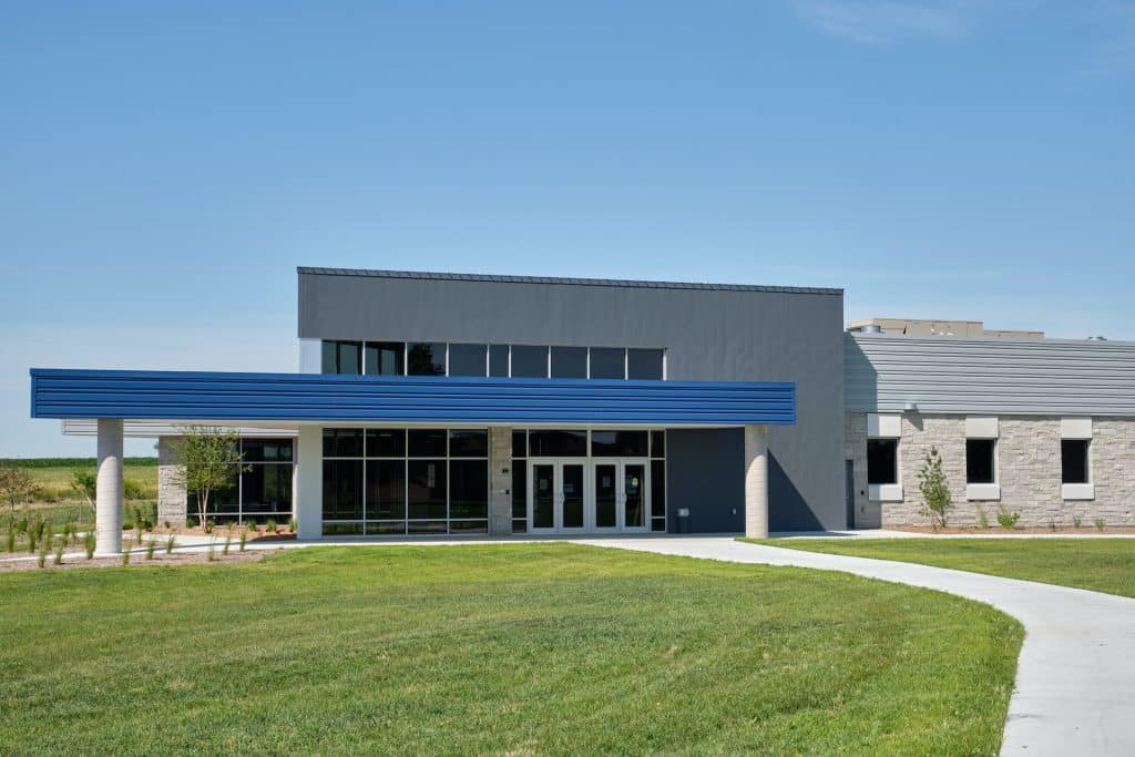
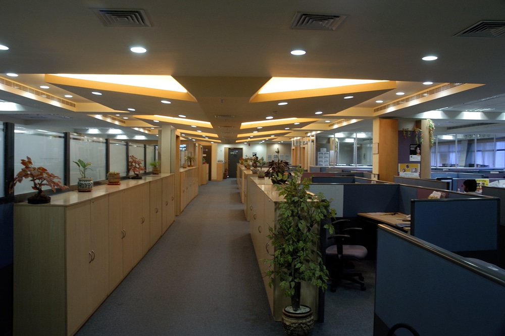
Laser surveying in offices
Surveying in office environments presents a unique set of challenges, particularly when working in occupied buildings. Often, tenants are unaware that a survey has been commissioned, (perhaps by a landlord with intentions for the building of which the tenants are not aware), which can lead to tension or even hostility from occupants.
Discretion is vital, and the deftness of the situation-sensitive surveyor to handle these delicate situations, while ensuring the survey proceeds efficiently, is an interpersonal skill acquired with experience.
A common issue in offices is the need to access areas above false ceilings, which can be disruptive and messy. Removing ceiling tiles to capture data often requires visits outside working hours to minimise disruption to daily office operations.
Navigating tight vertical angles in urban streetscapes can also prove challenging, especially when trying to scan tall elevations in confined areas with little room to manoeuvre. Features and detail at high elevations are often obscured. This can sometimes be mitigated by finding visibility at greater distance along the road, but greater distances require increased scan times and number of scans to link far scans effectively.
Safety is a significant concern in office surveys, particularly when working at height. Roof access, the use of ladders, and navigating hazardous spaces require adherence to strict health and safety protocols.
Tight plant rooms with intricate pipework can also be difficult to survey thoroughly, and in areas like electrical rooms, additional care must be taken due to the inherent risks. Asbestos awareness is crucial in older buildings, where it’s vital to ensure there is no disturbance to hazardous materials.
The diligent survey manager will ensure that the necessary training and safety gear, including harnesses, lanyards, and other personal protective equipment (PPE) are provided, which are essential for ensuring operator, building occupier and public safety, as well as for the protection of expensive, sensitive equipment. The building owners may also have their own safety protocols to which the surveyor must adhere, which may include forbidden access beyond safety barriers and other necessary, but survey-restrictive measures.
In some cases, features requiring survey from spaces that might not be specifically identified or cordoned-off by building owners, might well be unsafe, leading to the need for onsite judgement calls. Good internal risk assessment and health and safety policy keeps surveyors and everyone else safe.
Surveying internal areas, such as toilets, changing rooms and other private spaces, can be an understandable source of frustration for tenants. The experienced survey manager will anticipate such potential issues at the outset, as managing client and occupier expectations is crucial. However, access conflicts may not be apparent until the work is already underway, so good communication, planning and timing are vital to help keep everyone’s operations running smoothly. Staying flexible and responsive on site is in everyone’s interest.
The combination of safety considerations, challenging environments, and the potential for obstructive or uncooperative tenants usually means that only the most highly experienced and well-prepared surveyor teams will be able to effectively handle office surveys with the level of precision and discretion required.
Laser surveying on building sites
Building sites offer some of the most challenging environments for laser surveying. The presence of heavy machinery, ongoing construction, and constant movement creates a highly dynamic and often unpredictable setting.
Large machinery and even smaller handheld equipment can shake and vibrate the floor/ground, impacting the stability of the laser scanners and reducing data quality.
Plant movement can be constant, and space is often limited, making it tricky to find a safe, clear area to set up the laser scanners. In these environments, equipment is at risk from dust, falling debris, and water which can obscure lenses, distort the results and damage equipment. Keeping the scanner’s optics clean is essential for ensuring accurate results.
Navigating such a site is not just about the survey technology. It requires patience and a strong understanding of site operations. Surveyors often have to work around various tradespeople, all with their own tasks to complete. This requires a level of consideration and coordination, ensuring that everyone can work efficiently without interfering with one another.
Safety training, PPE and the need to hold up-to-date CSCS cards is mandatory on a well-run site, ensuring surveyors understand the hazards of working on active construction sites and how to mitigate them.
Often a building or structure requiring survey will be covered in scaffolding. Scaffolding will obstruct clear views of the building or make it difficult to establish Total Station or scanner links between internal and external spaces. Additionally, scaffolding is too unstable for effective scanning, with tradesmen working on it at the same time as the surveying team (even just wind can shake the scaffold beyond useable scanner footing), causing further challenges for laser accuracy.
Given the numerous moving parts and risks associated with building sites, a combination of skilled operators, safety training, and robust planning is required to ensure that laser surveys can be completed efficiently and accurately in these high-risk environments.

Environmental and operational challenges
The threat of equipment theft is another ongoing challenge. With expensive, high-tech equipment in plain view, surveyors must remain vigilant, securing equipment with wrist straps (which can be awkward to work with) and sometimes hiring additional personnel to act as security. Surveyors have even faced threats of violence on occasion (though this is rare), making personal safety and the security of the equipment a major concern.
Various environmental and operational factors can impact the accuracy and efficiency of the scanning process on any given site. These challenges range from technical scanning limitations, to the unpredictable nature of working in different conditions and environments. Understanding these challenges and adopting the right strategies helps ensure the data captured is as accurate and complete as possible, while minimising disruption to the people around them.
Specific scanning limitations
During laser surveying we can encounter numerous specific scanning limitations that can hamper data capture and accuracy.
One significant issue is shadowing, where certain areas are obscured due to surrounding structures or objects. Careful placement of the scanner and extra set-ups can help, but the fact remains that sometimes some features are impossible capture without extra measures (including arranging access to neighbouring properties to acquire visibility, perhaps). This is a factor for the commissioner of the survey to decide.
Scanning technology is not perfect. Black or dark or shiny surfaces are often not visible to the scanner which may result in no data at all where these features exist in reality. It takes an experienced eye to notice these omissions and there are techniques that can be used in the office to identify these features to be able to show accurately on the final survey drawings.
Similarly, mirrored and wet surfaces can distort how the scanner sees its data, creating misleading information that does not exist. And opaque surfaces, such as polished marble tiles, often produce unclear data points, making it difficult to establish precise positions. Again there are work-around techniques that can be used in the office.
Puddles on the ground can also obscure ground levels and act as mirrors, further complicating the completeness of the survey and adding ‘data noise’ to the scans.
Additionally, surveying through windows or glass can lead to complications. Sometimes acting as mirrors (as above) and – harder to spot – refractions may distort the information behind the glass, rendering the data captured useless in accuracy terms.
Awareness of these specific limitations and an in-depth understanding of how the scanner behaves in different environments are crucial for surveyors to mitigate these issues effectively.
Environmental conditions
Various environmental conditions can significantly impact laser surveying efficiency and accuracy.
Climatic factors, such as heat, rain, wind, and freezing temperatures, can affect both the equipment and surveyor alike. While many instruments are designed to be weatherproof, heavy rain creates inaccurate readings (refraction), and the rain itself can be picked up as points giving an awkward cloud of data in thin-air.
Extreme heat and cold will create stresses within the instrument itself and will affect accuracy. Heavy wind can buffet a spinning scanner creating movement which distorts data capture, and also poses a threat of the scanner being blown over.
Understanding these environmental conditions is essential for surveyors to make informed decisions to maintain the integrity of the surveying process. Surveyors therefore need to monitor weather forecasts and plan surveys accordingly, avoiding extreme conditions to ensure optimal performance.
Moving objects
In bustling urban areas, cars, lorries, buses, and pedestrians can obstruct the line of sight during a survey, leading to data noise, hidden detail and obscuring visibility of reference targets and spheres necessary for accurate scan registration.
This unpredictability can complicate the scanning process, making it essential to plan surveys during low-traffic periods whenever possible.
The presence of ‘inquisitive’ bystanders can also interfere with the workflow. Whether it’s curious individuals asking questions, deliberately disruptive behaviour causing a threat to the equipment itself or an overly friendly dog innocently and energetically wanting to play, surveyors must navigate these interactions tactfully to maintain workflow, focus and efficiency.
As mentioned, theft is also a major issue, most likely in public settings, with high value survey equipment often specifically targeted. To mitigate these risks, it’s common practice to assign extra personnel as lookouts and/or to use wrist straps and lanyards to secure scanners. Sometimes, simply picking the scanner up mid-scan and moving away from a potential or real threat is the safest precaution. Vigilance and prudence are crucial for protecting surveyors, maintaining equipment security to ensure that the survey can be conducted safely and with minimal interruptions.
Unstable ground
The stability of the ground on which the laser surveying equipment is placed plays a vital role in ensuring accurate data capture.
Unstable ground, such as wobbly paving, polished marble floors, or other slippery surfaces must be avoided where possible. Surveyors must take care to position equipment on firm, stable surfaces, and use ‘spiders’ to secure tripod legs where there is a risk of the scanner feet slipping. But whilst these tools are useful, again it comes down to the ability of the skilled and experienced operator to adapt to the specific conditions.
Loft spaces
Conducting laser surveys in loft spaces presents its own set of challenges due to often cramped and dusty conditions.
Access to loft spaces can be limited, making it difficult for surveyors to position equipment effectively and capture comprehensive data. The need for precision in linking scans is crucial, yet the confined areas can impede the flow of work, and may require additional time to ensure all the necessary details are recorded.
Lofts can also often be bouncy underfoot, which calls for the surveyor to remain still during scanning to avoid errors.
Dust can also pose a significant issue (as mentioned), particularly acute in loft spaces, negatively impacting the scan quality. Clutter often creates obstacles and it’s also really important to be mindful of ‘antiques’ or valuables stored in the loft space (and anywhere else), taking care not to damage anything.
Patience, experience, skill and good planning allow surveyors to successfully navigate the complexities of surveying loft spaces, while maintaining accuracy and detail.
Navigating the challenges of 3D laser scanning with Callidus Surveys
3D laser surveying is an invaluable tool that offers numerous benefits, particularly in rapidly capturing detailed and accurate data across a range of building types.
However, as we’ve explored, there are specific challenges that we as surveyors must navigate to maximise the effectiveness of the scans and the value of the resulting drawings and models. From managing data noise, and shadows in busy environments, to ensuring optimum equipment settings for each specific application, every scenario presents its own set of obstacles.
The importance of operator skill in overcoming laser scanning challenges cannot be over-emphasised.
At Callidus Surveys, we’ve invested in the highest specification 3D laser surveying equipment, allowing us to deliver surveys of the finest detail, with a rapid turnaround.
With many years of experience, and a team made up of some of the UK’s best-trained laser surveyors with construction industry knowledge that’s unrivalled in the sector, you are guaranteed the skill required to overcome the typical challenges thrown up by 3D laser scanning.
If you’d like to book a 3D laser survey with us, simply send us your specification and we’ll respond with a tailored quote.